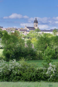
Cheval du Roi

Difficulty: Easy
Distance: 5
km
Positive Elevation: 84 m
Time: 1h15
From La Salvetat take the D905A towards Villefranche.After about 5km, just before Pradials, turn left towards Lescure. At the entrance to Lescure, follow the road on the left, signposted Cheval du Roi.Park on the roadside at the path which leads to Cheval du Roi.
Start by walking up to the Cheval du Roi viewpoint. Come back down and turn left for 300m to the crossroads. Take the second road on the right (which is almost opposite you) and follow this for 500m towards Flauzins, before taking the path on the left, just before Mas del Bosc.(at a small yellow sign marked “Cheval du Roi/ les Cayroux”. This takes you to Flauzins. Have a walk round the village then take the road on the left to Sauzet and have a look round the village. To get back to the start, take the road on the left just before the entrance to Sauzet. After about 70m you can take the path on your left to an observation tower (additional 50m climb plus three storeys).
The topoguides are sold at the tourist information center with all the waypoints and cultural information about the points of interests.
Get all our tracks on your smartphone with the Cirkwi APP, or with an app of your choice as GPX viewer.


